Saturday, January 09, 2016

Remembering Doug Walker

Doug Walker was one of those guys I always thought was invincible in the mountains, a view that anyone who saw him scramble up a mountain likely shared--sadly his death is a reminder that none of us are.

I remember when I first met Doug over 15 years ago (I doubt many can forget their first  time meeting Doug) at a fundraiser for a conservation group where he was being honored for his contributions. As the event staff tried to clean up the room and the crescendo of stacking chairs increased (in a vain attempt to give us all the message it was time to go home) Doug was peppering us all with an endless stream of geography trivia.

I'll admit that the geography quiz (or Civil War quiz) was not something I ever engaged in and seeing me roll my eyes when he started in with me at an event at his house one evening he quickly sensed my lack of interest. We instead got into a discussion of art history and discovered we both had an interest in the painters of the Hudson River school. I told him about a lecture I had been working to develop on the subject of the importance of the western landscape painters for educating members of Congress in the effort to designate Yellowstone National Park (beginning with Thomas Moran's participation in the Hayden Expedition) and the evolution of our advocacy for public lands from landscape paintings to Instagram. Doug was intrigued and soon we had left the party he was hosting behind and disappeared for the next 20 minutes talking about art as he showed me some of his personal collection in rooms throughout the house. As the finale on the tour he took me to a room where he casually showed me a painting from one of the more well-known 19th century landscape artists--an individual whose artwork we had been discussing earlier in the evening. The experience was a remarkable example of the breadth of Doug's knowledge and intellectual curiosity: "you don't like my Civil war trivia?; OK, I'll meet you at your interest in art history." Not only had he met the challenge of letting me choose the subject of 19th century art history; he had a painting in his house of one of the very artists I had brought up in the discussion!

Doug and I crossed paths on a regular basis; we served together on the board of Forterra, the Advisory Council of The Mountaineers, and he was a board member of Outdoor Alliance where I serve as one of the policy chiefs. I would get the occasional phone call from him that usually started with, "what do you think about..." He always had his own thoughts on the matter but challenged me to go first. Through all those conversations however he was genuinely interested in my perspective. As the dialogue ensued he would challenge my own thinking and approach. Having a conversation with Doug could be intellectually exhausting but I always benefited from the exchange. Doug had that impact on people: he could make you a better climber or a better critical thinker as he challenged you to reach your full potential and then exceed it.

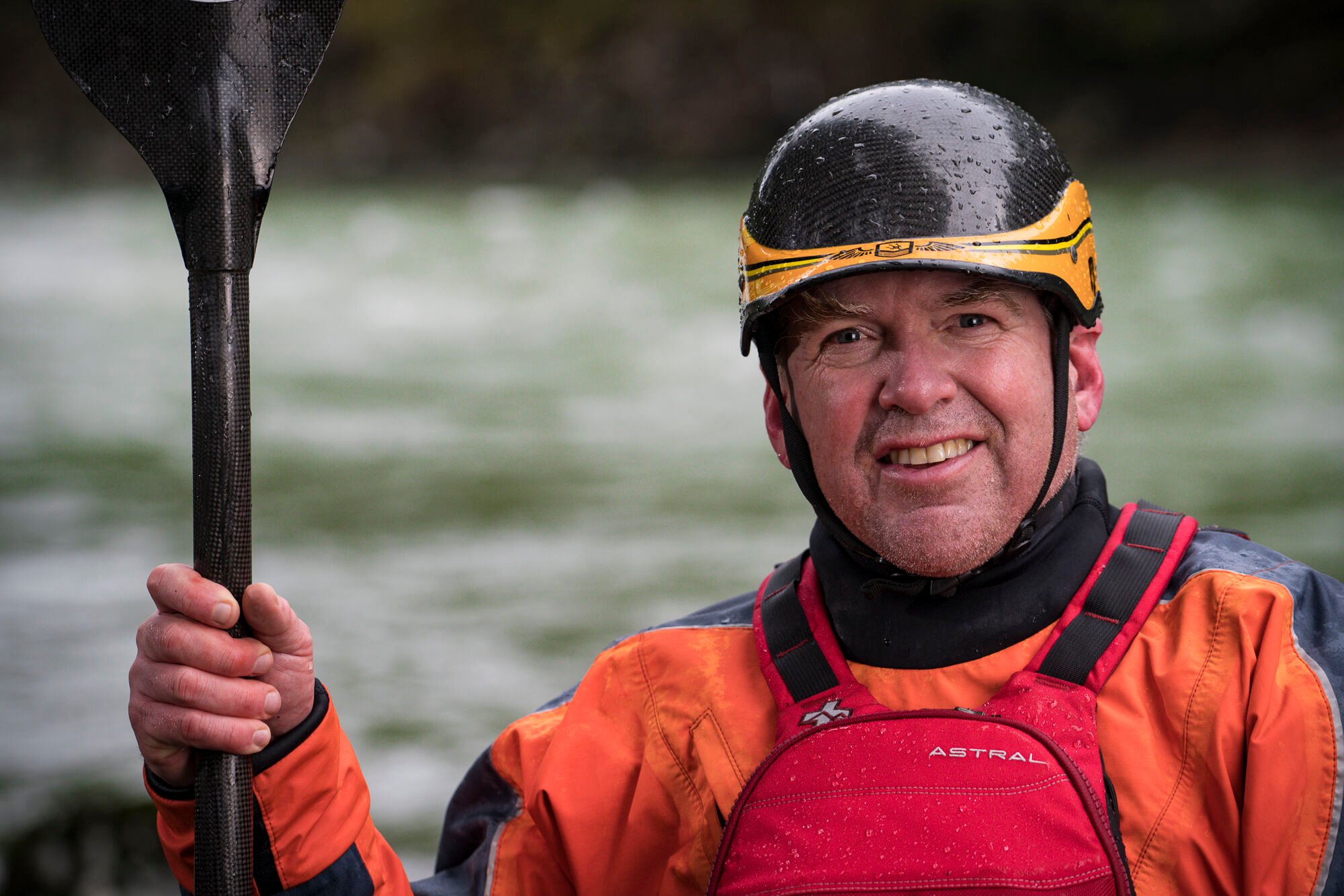
Doug was not one for the coffee shop meeting; if you had something to discuss you met at the climbing gym or on a trail in the North Cascades. Photo credit: Luke Humphrey, via The Mountaineers.

Doug recognized talent and passion in individuals and while he was mentoring me to become successful in river conservation, and think beyond the nose of my kayak, he was also mentoring countless other individuals--Martinique Grigg as she took the helm of The Mountaineers and worked to make it more relevant to families and a younger generation, Ben Greuel as he sought to bring new leadership to The Wilderness Society's work in the Cascades through initiatives that recognize the importance of both conservation and enjoyment of our public lands, Joe Sambataro as he developed a program with the Access Fund to bring the tactics of a land trust into the toolbox for the climbing community, Eddie Espinosa as he worked to implement the vision of the American Alpine Club to become more relevant to climbers through regional programs and services, Martin LeBlanc and his work to make the the dream of no child left inside a reality, Adam Cramer as he sought to build a new and effective coalition for outdoor recreation known as the Outdoor Alliance, and the list continues.

Many of us Doug mentored are in mid-career; we've been at it for a few years but still have potential to do some great things. Doug was quick to recognize that potential and willing to invest his time, money, and intellect to help us realize it. By any measure Doug was a successful individual--as a businessman, an outdoor athlete, a community civic leader, and an advocate for conservation and recreation--and he had a passion for helping others reach their potential to be successful. Sadly there will be no more of those engaging conversations, but I will remain forever grateful for the time he spent with me as a mentor and a friend. I know there are many of us who feel the same and his impact on our careers will live on.

Doug left us all a lifetime of work (and perhaps a little more). Now it's up to us to go out and execute. I'm sure he would remind us to remember to have fun--even if it's a little type II fun--and enjoy ourselves along the way.

Words from others:


Labels: , , ,

Wednesday, October 30, 2013

Restoration of the Elwha River


Originally Published in the Mountaineers Magazine, July/August 2013

The Elwha River is unique among rivers of the Olympic Peninsula with a watershed that represents approximately 20% of Olympic National Park and headwaters reaching to the very center of Olympic Mountains. These mountains were formed by the domal uplift of marine sedimentary rock and basalt that the powerful Elwha River has carved its way through. The rich geologic diversity that resulted has been sculpted by the action of flowing water, the errosive power of sediment, and the persistent grinding action of the glaciers that have all shaped the landscape. The Elwha River of recent geologic history has all the attributes of river that is well suited for the suite of species that comprise the Pacific salmon, its deep canyons and diverse geology create one of the region’s classic backcountry whitewater destinations, and all the power and volume of a river descending from the mountains to the ocean over a distance of just 40 miles made the river an early candidate for hydropower development.


The Elwha Dam was not the first dam across the Elwha as the Vashon ice sheet dammed the river forming glacial lake Elwha a little over 10,000 years ago. Beneath the forest canopy the observant hiker can find evidence of glacial terraces, perched deltas, and moraines that provide evidence of the old lake that disappeared with the retreat of the glaciers. As can be observed today in Alaska where glacial retreat has exposed new river habitat, salmon discovered the Elwha and found a rich diversity of habitat. The powerful rapids and cascades of canyon sections of the Elwha exerted strong selection pressure for massive Chinook salmon, pink salmon found ideal habitat in the lower gradient reaches closer to the ocean, and sockeye had access to important rearing habitat in Lake Sutherland. The abundant fishery resource became an important food and cultural resource for the Klallam people, central to the identify of those who called the valley home.


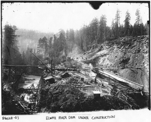
In 1882 the world’s first hydroelectric project began operation on the Fox River in Wisconsin and with it came ambitous plans to harness the power of rivers to generate electricity and fuel industrial development. Thomas Aldwell located a homestead on the Elwha and slowly began accumulating the land necessary for the development of a hydropower project over a period of 20 years. Where the Klallam people had found a fishery resource that sustained their community, Thomas Aldwell looked upon the river and determined that it was “no longer a wild stream crashing down to the Strait; the Elwha was peace and power and civilazation.” As Aldwell worked to secure the financing, construction of the Elwha dam commenced in 1910. The dam was not anchored to bedrock but instead set on glacial alluvium—“a dam on roller skates.” Shortly after construction in October of 1912, the dam failed in spectacular fashion when the river blew out through the gravel below the dam. Rebuilding commenced and by the end of 1913 the Elwha was no longer a free-flowing river as electricity flowed from the powerhouse to Port Angeles and beyond.


Decommissioning the hydropower projects on the Elwha was a project that took several decades. By 1927 a second dam had been constructed at Glines Canyon which was subsequently included within the boundaries of Olympic National Park. In the mid 1980s as the Federal Energy Regulatory Commission (FERC) continued to slow walk the license applications for the two dams, Rick Rutz made the observation that FERC did not have the jurisdictional authority to license a hydropower dam in a National Park. It took several years but by 1992 the audacious idea to remove the dams inched closer to reality with the passage of the Elwha River Ecosystem and Fisheries Restoration Act. All that remained was the “small matter” of securing the funding for the project, but by September 2011 the project was underway as an excavator set to work and began to break up the concrete and dismantle the dam that Thomas Aldwell had worked so hard to build. But this dam’s time had passed, and the environmental costs associated with its continued operation greatly exceeded the small amount of power it produced. At the official ceremony to mark the occasion, Bureau of Reclamation Commissioner Mike Conner remarked, “Dam removal is not the best option everywhere but it is the best option here. and it's the best option in a lot of places because the process that we are going through these days is we are reassessing the costs and benefits of certain facilities that exist today… I think this is not only a historic moment here but it's going to lead to historic moments elsewhere across the country.”


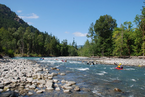
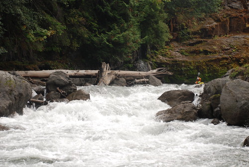
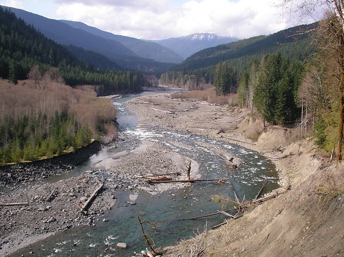
Today the Elwha Dam is gone and the river explodes through an impressive rapid in the heart of the canyon where the dam once blocked its flow. Only 50’ of the 210’ Glines Canyon Dam remains as work continues to completely remove it. Already salmon have been finding their way upstream of the Elwha Dam site and the river offers ample opportunities for exploration where one can witness first-hand what it means to restore a river.


Destinations for a Day Exploring the Elwha

River Mouth

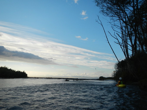
The river mouth is quickly transforming as the cobble beach transitions to sand as predicted. To explore the new beach environment head approximately 5 miles west of Port Angeles to Highway 101 mile 242.5 and take Highway 112 west. Continue on this road for 2.1 miles (crossing the river) to Place Road. Turn right (north) and follow this road 1.9 miles to the T junction and then turn right (east) on to Elwha Dike Road and continue 0.1 mile to the Elwha Dike access point. Day-use parking is available along the road. Hike a couple hundred yards along the trail towards the ocean.


Elwha Canyon

To see the site of the Elwha Dam site, head approximately 5 miles west of Port Angeles to Highway 101 mile 242.5 and take Highway 112 west 0.7 mile to the Elwha River. Just before crossing the Elwha bridge turn left (south) on Lower Dam Road which is also the turn for Elwha Dam RV Park. The parking area for the trail is to your immediate left. The first 200 yard section of trail, constructed by Clallam County, is wheelchair accessible and leads to a partial overlook of the former dam site. As you approach this first overlook you will see the start of a 1/4 mile footpath to your left. This trail was built by a Washington Conservation Corps crew and leads to an overlook that provides the best view of Elwha Canyon and site of the former dam.


Former Aldwell Reservoir

The former reservoir is a fascinating landscape of gravels and sand held back by the dam, old stumps with their springboard notches standing as reminders of the day the riparian forest was cleared prior to flooding the reservoir, impressive views back up the valley to the Gates of the Elwha proposed wilderness, a river that is carving its way through a century of sediment, and evidence of vegetation that is slowly reclaiming the corridor along the river. To see all this head about 8 miles west of Port Angeles to Highway 101 mile 239.4 just after crossing the Elwha River bridge. Turn right (north) onto Lake Aldwell Road towards Olympic Raft and Kayak. Continue on the road 0.2 mile to the end and the old boat launch that was on the reservoir. From here you can hike out onto the old reservoir and spend several hours exploring or just a few minutes.


Former Mills Reservoir and Geyser Valley

While Glines Canyon Dam is still an active construction site, you can drive up to explore the upper reaches of the former Mills Reservoir and the backcountry upstream. Head about 8 miles west of Port Angeles to Highway 101 mile 239.5 and turn left (south) onto Olympic Hotsprings Road through the National Park entrance. Continue 4.0 miles up this road and take the left-hand turn up to Whiskey Bend. As you proceed up this road you will pass the Glines Canyon Dam site at mile 1.2, described by members of the 1889 Press Expedition in colorful prose as an area “rather unsafe for any nervous youths to travel.” Continuing up the road to mile 4.0, there is a trail that leads down to the exit from Rica Canyon and the historic start of the Mills Reservoir (marked with a small sign that reads, "to Lake Mills"). Although the 0.4 mile trail is steep it provides an opportunity to explore the upper end of the former reservoir and the exit of Rica Canyon.  The road ends another 0.4 mile past this trail at the Whiskey Bend Trailhead. From here it is a 1.2 mile hike to the junction of the Rica Canyon trail which heads 0.5 miles down to the river and the downstream end of the Geyser Valley. In contrast to the reaches downstream that are struggling to digest 34 million cubic yards of sediment, the Geyser Valley is a great place to see what a floodplain forest would normally look like. It provides an interesting contrast and a potential future view of what a restored Elwha forest could look like along the lower reaches someday.


More Photos of the Elwha

Videos:

Altair to the Sea: Kayking Down the Elwha

Going Home: The Salmon Return

Fire in the Hole: Blasting a Dam

Labels: ,

Friday, November 16, 2012

The White Salmon Runs Free!


Many of us wondered if the day would ever arrive, but after years of waiting it finally came in the form of a text message from PacifiCorp staff on a Saturday in November: “It’s official. The White Salmon is open! Spread the word. Safe paddling to all.” And with that, paddlers hit the water to experience a truly remarkable treasure—a new section of river that for the past century was buried beneath the placid waters of Northwestern Reservoir.

On an overcast morning a week later, we gathered on the banks of the White Salmon River giddy with anticipation for the opportunity to experience a new river. Just a year before, many of us stood on the lip of Condit Dam and watched the dramatic results of the explosive blast that breached the dam and drained the reservoir in a little more than an hour’s time—a reservoir that had been there for a century vanished before our very eyes. It was easy to view the scene before us as a wasteland of mud and debris, and hard to imagine it would ever look like a river again. But as we’ve observed at dam removal projects across the country, rivers have an incredible capacity for self restoration.

Over the months that followed the dam breach, contractors chipped away at the dam. It slowly shrunk in size while the mud washed away and the river began to flow clear again. This past September, the dam was completely gone, and as amazing as this may sound you could hardly tell where it once stood. Agonizing days then became weeks as the contractors continued their work to restore the river channel below the dam, which included removing massive logs that had once been buried in the reservoir sediments and then wedged in the White Salmon Narrows. Finally, the most hazardous logs to navigation were all removed, and PacifiCorp declared the river open for public use. Our day to experience the river had finally arrived.

We began the day’s journey from Wet Planet in Husum, launching as a flotilla of more than a dozen kayakers and at least as many rafters. The run began on the mild Class II section of the run known as the Lower White Salmon, which historically ended with the slackwater of Northwestern Reservoir. The river continued on at a good pace with fun Class II and a couple good features as we slowly descended below the surface elevation of the former reservoir. Old stumps appeared that were buried beneath the reservoir sediments for a century, and we could see vegetation starting to colonize the newly exposed banks, while the basalt outcrops along the banks were scrubbed clean of the thick coat of mud that had buried them.

Floating the White Salmon River through what was once Northwestern Reservoir.

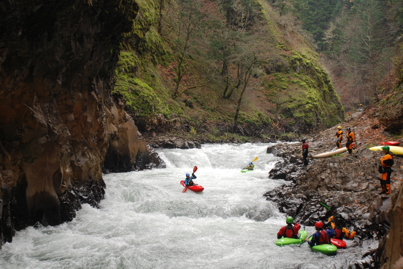
Halfway down the old reservoir the river flowed past a dramatic basalt cliff on river right, with a bathtub ring stain marking the surface elevation of the historic reservoir. Here the gradient picked up and the river crashed through some great Class III whitewater as it followed a serpentine path through an incredibly beautiful section of basalt gorge with waterfalls cascading in. The scenic beauty of this section will only be enhanced as maidenhair ferns and mosses colonize these walls. Floating through this section, anticipation built as we passed through the bedrock gates that marked the site of Condit Dam. We could hardly recognize that a dam once towered over 100’ above this point, but whoops of joy echoed between the gorge walls as we pulled out on a gravel bar on river right to savor the moment. A spontaneous celebration ensued as Pat Arnold, representing Friends of the White Salmon, popped the cork on a bottle of champagne.

Just 40 years ago the White Salmon River faced a grim future with a proposal to develop a series of seven dams to harness the entire length of the river for hydropower. Friends of the White Salmon, a locally based advocacy group for the river, successfully fought off that proposal and in the early 1980’s began to advocate for restoration of salmon on the White Salmon River. At first the discussion focused only on fish passage around the salmon-blocking Condit Dam, but when PacifiCorp filed an application in December 1991 to renew their license for the hydropower project, the idea of dam removal began to germinate.

American Whitewater and Friends of the White Salmon made the first formal requests for a study of dam removal in 1992 as part of the federal licensing process. Rich Bowers was hired as American Whitewater’s first Conservation Director thanks to support from the Conservation Alliance and member companies, including Patagonia.

In comments filed that first year of the licensing process for Condit Dam, Rich wrote that a study was needed to “determine the recreation, fishery, flood damage mitigation, power production and other impacts associated with the removal of impoundments and in returning the White Salmon River to its truest sense of 'run-of-river'.” In 1993, during scoping for the Environmental Impact Statement, Rich requested “a detailed analysis of the whitewater boating opportunities in the lower White Salmon River that would be reestablished under a dam removal alternative, as well as the economic value associated with those expanded opportunities”.

In 1996, federal regulators completed a review of PacifiCorp’s license application and determined that keeping the dam in place and upgrading facilities to meet “modern environmental standards” was the preferred alternative. During the time when John Gangemi represented the interests of whitewater boaters for American Whitewater, it became apparent that the required upgrades were going to be much more costly than dam removal. The dam produced very little power and it became clear that the dam could not produce this power economically. Katherine Ransel, working for American Rivers, represented a coalition of conservation groups including American Whitewater and successfully secured a settlement agreement between dam owner PaciifCorp, resource agencies, and river conservation groups for dam removal. The agreement was signed in 1999 and called for the dam to be removed in 2006.

Federal regulators analyzed this agreement and recommended dam removal as the new preferred alternative in 2002. The plan was not without controversy however, and at a memorable public hearing Daniel Dancer launched into his song extolling the glories of a salmon returning to a free-flowing White Salmon River, to the tune of Neil Young's “Long May They Run.”  Foes of dam removal raised their collective voice in an impromptu “God Bless America” and pandemonium ensued as federal regulators threatened to shut down the meeting. Order was restored and Daniel was allowed to finish his musical testimony but it was not an end to the controversy. Despite the objections, the removal plan moved forward. As the date for removal approached in 2006 however, it was clear that the project was languishing and the County even mounted an effort to acquire the dam from PacifiCorp. The necessary regulatory steps were not proceeding in part due to continued opposition from the County and a pending threat of litigation. It was around this time that Keen Footwear stepped up to support American Whitewater’s effort to launch a stewardship program based in the Pacific Northwest. With a regional office in close proximity to the project, American Whitewater was able to take on a leadership role in moving the agreement through the final steps of the regulatory process. Working with our partners in the Hydropower Reform Coalition—it was truly a team effort involving several local, regional, and national organizations—we got the project back on track and applied the consistent pressure that was necessary to bring the project to fruition. As we all stood near the bank of the river above the dam that day a little more than a year ago and felt the ground shake with the blast of 700 lbs. of dynamite we knew there was no turning back—Condit Dam was destined for removal.

Standing there at the base of Condit Dam a year later drinking champagne, it was rewarding to reflect back on the long journey that had brought us to that day. Watching the joy and excitement on everyone’s faces, it quickly became apparent what really brought Condit Dam down. It was not the poor economics of the project, the power of the Endangered Species Act, or even the fishway prescriptions resulting from Section 18 of the Federal Power Act. It really came down to a simple fact—people care deeply about this river. It was the kayakers who went out to enjoy the river on their free weekends,  the fishermen who have a spiritual connection to the river, members of the Yakama Nation whose connection to the river predates all of us, the school kids who acted out the dam breach at countless public hearings, and others who just enjoyed hanging out by the river. For all those people, the White Salmon River mattered and it was this community of folks who ultimately brought the dam down.

Standing there at the former dam site, our celebration wasn’t done–we all had more new river to run. Soon we were back in our boats in nervous anticipation of Steelhead Falls  a short distance downstream. The mile and a half below Condit Dam was largely dewatered over the past century as the flow of the river was routed through a pipe to the powerhouse downstream. While some had explored this section of river over the years, it was largely characterized by a series of stagnant pools harboring the debris and detritus that occassionaly washed over the dam. This section contains the most significant whitewater on the run as the river plunges over Steelhead Falls, a ledge drop that feeds into a meaty hydraulic that is Class IV to V depending on flows. About half the group portaged the falls-including the rafters, but several folks fired it up and everyone styled it. Those considering their first run are advised to go with someone who can recognize the drop because it comes up quick at the end of a Class III rapid. As flows increase the intensity of the hydraulic builds and the portage route closes out. Below Steelhead Falls the river passed through one of the most dramatic sections of river anywhere—the White Salmon Narrows, where gardens of mosses and ferns spill in over the high gorge walls that are beautiful organic fomations of pillow basalts.

Susan Hollingsworth paddles through Steelhead Falls.

Emerging from the Narrows, the river passed by the old powerhouse on river left and it was in this section that we saw the most spawning salmon. Massive fish made good use of the abundant supply of gravel that can now move downstream and is no longer held back by Condit Dam. All were deeply moved by the presence of these majestic fish that were so quickly taking advantage of the benefits of this restored river. A short distance downstream, the river cascaded through one final Class III sequence before settling in to the calm waters of the pool held back by Bonneville Dam on the Columbia River. It was only about a half mile of flatwater paddling down to the point where the White Salmon joins the Columbia and the take-out. While the take-out marked the end of the day’s journey it was really much more than that. It was the end of a long road extending over decades to see this project come to a successful outcome, and it was the start of a new beginning for a restored White Salmon River.

Labels: ,

Wednesday, August 01, 2012

Explosive


Thomas O’Keefe, American Whitewater’s Pacific Northwest stewardship director, stood on the banks of the White Salmon River in Washington State. The scheduled explosion was running late. As Tom looked downstream, he could see what was left of the river after 100 years – shallow pools of water starved of sediment for the past century. Upstream were the staid waters of Northwestern Lake, the five-story wedge of silt underneath invisible.

The river had run the same course as a stream near Tom’s childhood home in upstate New York. Tom played and fished in creeks and streams when he was young, and an old Civilian Conservation Corps dam held back the waters of one in particular. Over the years, silt had accumulated in the reservoir behind it, and the water was only a few inches deep. Tom would scan the surface for the tiny trout that still lived there.

Tom often thought about that dam. As a river ecologist and kayaker, he saw how dam owners corralled rivers upstream and downstream with fences, preventing people from experiencing rivers as he had. Tom also spent time on hundreds of wild, free rivers around the world, and began fighting to protect and restore them – for wildlife and for people. In his efforts over the last decade to put water back, tear down outdated dams and increase the opportunities to enjoy them, he highlighted the many recreational and educational benefits of free-flowing rivers.

As Tom waited for the dramatic conclusion to the nearly three-decade-long fight to remove Condit Dam, he knew that others would someday experience the White Salmon the way he had experienced so many other rivers.

A warning horn blared. Someone yelled, “Fire in the hole!” A low rumble resonated from the river canyon and the ground shook. Seven hundred pounds of dynamite blew a hole the size of a two-lane highway in the bottom of the 12-story cement structure, draining the water it held like a giant bathtub. The sound of the White Salmon River exploding free echoed from the canyon below. Dark, sediment-filled water gushed, restoring access for salmon, steelhead and people.

To learn about what you can do to help conserve and restore our rivers – and enhance opportunities to enjoy them – visit americanwhitewater.org.

From the Early Fall 2012 Patagonia Catalog featuring essays on Dam Busters

Labels: ,

Thursday, October 02, 2008

A Day on the Skagit River

Our raft dropped into Goodell Rapid a wave crashing over the side of our boat as my three-year-old son giggled with excitement. He sat on the center seat next to me, my parents were in the front, and the entertainment of watching Grandma and Grandpa being splashed by the Skagit River was providing more enjoyment than Saturday morning cartoons.

The Skagit has always been one of my favorite rivers and a place that I always take out-of-town visitors--for me, the river defines the Pacific Northwest Experience. While a section of the river is harnessed for hydropower, providing a significant contribution to Seattle's power needs, careful attention to management of the river and the hydropower system has provided that elusive balance that is so often hard to achieve. The river itself is one of the most spectacular rivers on the West Coast. It provides approximately 20% of the water flowing into Puget Sound and is home to all five species of Pacific salmon with some of the largest and healthiest wild Chinook and pink salmon runs in the region. Mature riparian forests provide habitat for wildlife including hundreds of eagles that overwinter.

But the best part about this river is that it is simply a great place to go out and enjoy a day on the water. I have visited hundreds of rivers around the country and I can think of few places that approach the Skagit as an accessible river that provides opportunities for wildlife viewing, world-class fishing, and rapids that provide a thrill for those who want a taste of what the higher gradient rivers of the Cascades have to offer.

As I continued the journey downstream with my family we gazed deep into the crystal clear water where we could see salmon on their own journey up the river. A family of ducks pulled into an eddy and a eagle soared overhead. Forests climbed the steep valley walls and disappeared into the clouds above, a tranquil autumn scene as the vine maples showed the first signs of turning.

The quiet pace was soon broken as we drifted into the S Bend Rapids, a trio of challenging class III wave trains that represent the most difficult whitewater on the run. Prior to our run I had stopped along the road above these rapids to scout out a line that would keep my passengers dry. I told everyone to hold on as we slid onto the tongue of the rapid--the calm before the storm as the waves churned white just below. I pulled to the left, but my timing was just a half second off as I tried to skirt the biggest wave below which crashed over our boat. We pulled into an eddy below and my mom shook off the water like a wet dog as my son laughed.

Soon after our ride through the rapids we pulled into the take-out at Copper Creek. In the early 1980's this was the site for a proposed hydropower project that would have inundated the section we had just run. Today the river runs free and I hope it stays that way. We all use electricity but the river also provides another kind of power--the power to draw one into the natural world, connecting us with friends and family, and reminding us what it means to be alive.

Labels: ,

Saturday, December 02, 2006

Wilderness on the Calawah River

I look forward to Thanksgiving every year and our annual trip out to the Olympic Peninsula to explore rivers and enjoy good times with friends and family. I've been heading out there for about ten years now and working my way through Gary Korb's guidebook to the whitewater rivers. I have always thought of my kayak as a way to experience the rivers and forests of the Olympic Peninsula in much the same way that others hike the trails.

Some of our experiences on the OP's "blue trails" are better than others but it's always an adventure. Last year we got on the Lyre, which drains Crescent Lake to the north and is a relatively young river that formed following the landslide that separated Lake Crescent from the Elwha Drainage. As it turns out the river does not have the transport capacity to move wood downstream and we proceeded to hike down the river with our kayaks as we made our way over, under, and around dozens of log jams.

Most of our trip down the Lyre went something like this as we didn't actually spend much time in our boats.

I'm not sure I'd call what we did on the Lyre a paddling trip but it was certainly an adventure. This year we turned our attention the South Fork Calawah. This river flows through a corner of Olympic National Park which offers some of the region's most incredible opportunities to explore wilderness rivers. With my friends Mike and Omar we set out for the river which requires some effort. You have to drive to the Rugged Ridge Trailhead on National Forest land and then hike approximately 3 miles into the river. The trail was in good shape but we quickly realized that it had not received recent maintenance. We had to hike over some downfall and the trail was washed out at most of the stream crossings. After traveling about 1/3 of the way, and with memories of last year's experience on the Lyre, Mike decided to turn back.

After about 2.5 hours of hiking Omar and I were finally at the river. We took a break for a quick lunch and then launched off downstream. Within a short distance of the put-in the river squeezed between the narrow walls of a bedrock gorge that defines so many of the classic kayak runs on the Olympic Peninsula. Korb calls this drop West Virginia and we were able to boat scout our way into the canyon. Polished sedimentary layers towered overhead as waterfalls cascaded off the rim of the canyon walls.

Omar makes his way downstream after emerging from West Virginia.

In the canyon with waterfalls coming in from the sides.

More beautiful river in the canyons of the Calawah.


The bedrock canyons only last for a 1/4 mile or so before the river opens up and flows through beautiful old-growth forest. Impressive sitka spruce tower above the river on either side. The river itself remains interesting with fun boulder garden rapids that continue down towards the confluence with the Sitkum where the river begins to open up. Once we joined the Sitkum we were on a slightly bigger river and out in the National Forest. We continued on to the confluence with Hyas Creek where our car was waiting.

The South Fork Calawah was a great trip and a beautiful wilderness river that is accessible to intermediate paddlers. It does require significant effort to get in as the hike is moderately strenuous with some up and down over half a dozen small tributary drainages you need to cross on the way to the river. For a wilderness river experience the river itself is amazing and although it's a short trip, I would highly recommend it for those who enjoy exploring the rivers of the Olympic Peninsula.

While the trip on the river was memorable the real adventure was getting back home. Although my Prius provides great fuel economy it is not a snow car. With 6-8" of snow along Highway 101 we only barely made it home. We had to get a pushed out of the snow three times, and just making our way the 15 miles along Lake Crescent took about 3 hours. We did make it home though and I'm sure we'll be out again next year for a new adventure I have in mind.

Cars lined up along Highway 101 by Lake Crescent.

Labels: ,

Monday, November 06, 2006

Beyond the Guidebook

Exploring the Upper Sultan Drainage.

One of the great things about living in the Pacific Northwest is the thousands of river miles available for exploration and adventure. While I have been a lifelong paddler, that's just a means to the end of my real passion which is exploring rivers.

While the classics of the Cascades have probably been discovered there are still some nuggets to be found here and there. Over the past few years groups have explored upstream reaches of Canyon Creek on the Stillaguamish, Lightning Creek in North Cascades National Park, North Fork Tolt, and the North Fork Skokomish in Olympic National Park. These explorers have returned with reports of sections of rivers few have seen. Over the past couple years I have been a stakeholder in negotiations over the future management of the Sultan River which provides water and power for Snohomish County. Andy Bridge, who designs paddles for Werner Paddles, lives on the river and has been the primary local volunteer engaged in this effort. While our focus has been on the incredibly scenic gorge reach below Culmback Dam, Andy has been exploring the upper reaches of the watershed where steep creeks emerge from some of the most rugged terrain in the Cascades. So when Andy called me this past weekend to say levels looked good for an exploratory on Elk Creek, I knew it was time to dust off the creeking gear and call a start to the fall boating season.

Shuttle logistics are easy on Elk Creek: you hike up as far as you want to paddle. The road ends at the bridge across Elk Creek and the wilderness of the Upper Sultan begins. This is not true Wilderness as the drainage shows past evidence of harvest activity, but as you step off onto the old road up the valley that is being reclaimed by the forest you quickly realize you are entering a region where few individuals pass. On the borders of the proposed Wild Sky Wilderness this is rugged terrain without maintained trails but here you find opportunities for exploration less than 2 hours from downtown Seattle. Remnants of old-growth remain and high bedrock walls tower overhead. Thick tapestries of moss hanging down from trees along the trail were clear evidence of the more than 15' of rain this valley sees.

We hiked for about two hours up the old road bed and over a couple of creeks where concrete crossings provided evidence of a past era. As the road further degraded we hiked down the hill to the creek. When we arrived we found low water and were immediately faced with a large log jam to portage. As we shouldered our boats and began hiking downstream, we were left wondering if we had put in too high.

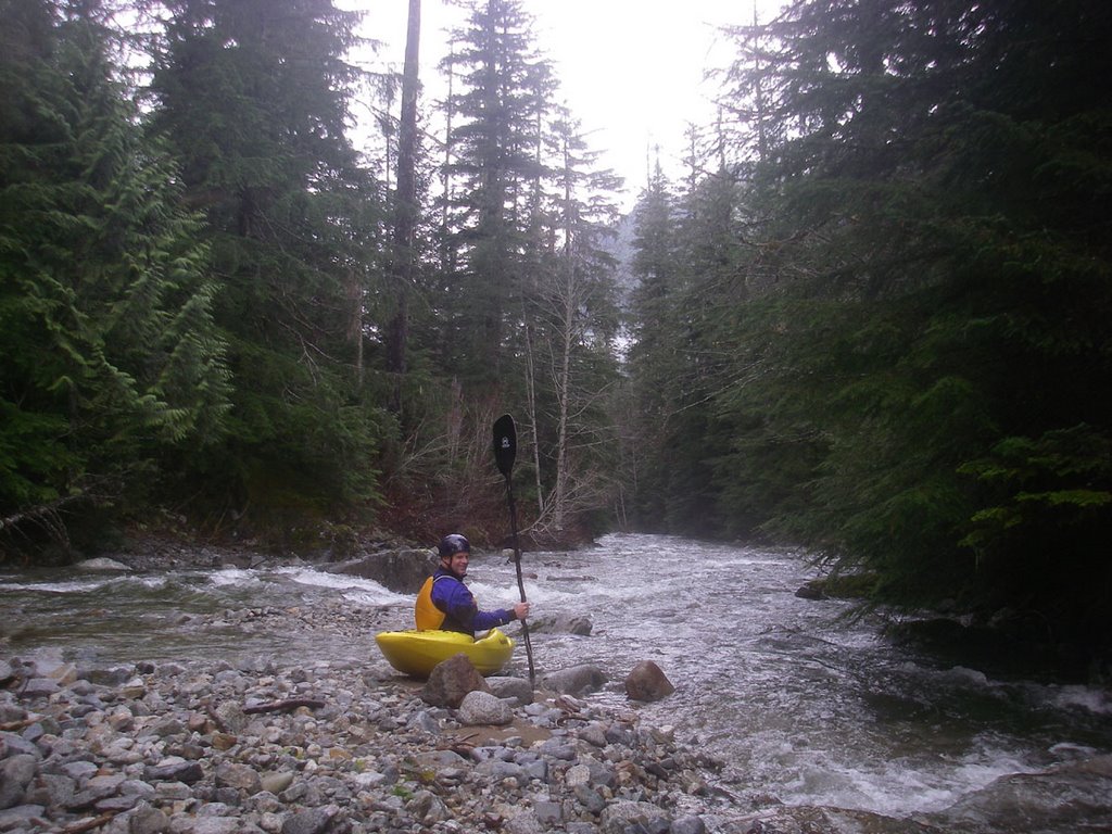
Andy Bridge at the put-in for Elk Creek.


Our situation quickly improved though as small tributaries poured in from the sides and the creek grew in volume. We had a couple more wood portages interspersed with some fun class IV. Impressive scenery bordered the creek as mountains disappeared up into the clouds and captured the moisture that fueled waterfalls hundreds of feet high.

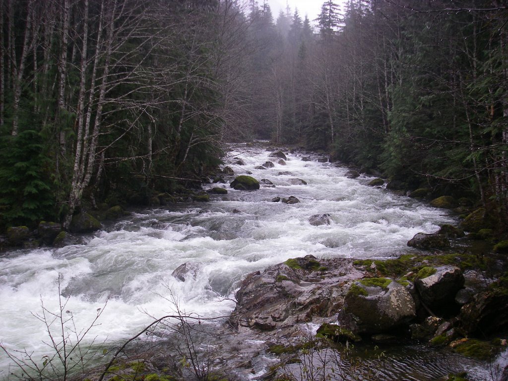
Elk Creek with Red Mountain towering up into the clouds.


After a couple more log limbo moves we started to really hit a groove as the creek began to weave its way through boulder gardens and dropped over a couple of ledges. We portaged part of a three tiered ledge although it did appear there was a line. We then came up to a rapid with a large boulder on river left. It looked like a fun drop but a few strategically placed logs, including one pointing straight out into the current, made the line just a little too tight. We opted to walk it but put in below to run some of the best rapids of the day.

Looking downstream into a fun class IV stretch.


We were crusing along when we came to a class 3 rapid that disappeared around the corner. It looked good but we could not see our next eddy so I hopped out for a look. I quickly realized that the river plunged into a challenging class V gorge. The entire river, squeezed between narrow bedrock walls, churned violently in a big hole at the entrance. Downstream we could see at least 5 more challenging holes. It was probably not unrunnable but it looked like potential trouble at this level so we began the difficult scramble along river left. From the bottom of the gorge we encountered great continuous whitewater including one of the best stretches of the run which begins upstream around the corner above the bridge and finishes off just below the bridge.

Looking upstream from the Elk Creek Bridge near the take-out.


After passing under the bridge we continued on downstream as the river tapered off to class III and once we hit our first log portage we decided to take-out and hike back up to the road.

Was Elk Creek a new classic? Not quite, but it was certainly a fun way to spend the day and great way to explore a hidden river valley that few people have seen and probably nobody else has paddled. Sections were reminiscent of the Foss or the Rapid in the Skykomish drainage but this run is shorter and with the hike in the run is more work to get to. Levels were about right for an exploratory (the nearby South Fork Sultan was at 300-400 cfs). It was a little low for some of the rapids but just right for others.

Labels: ,

Friday, November 03, 2006

Condit Dam: What's Next?

Klickitat PUD explores ownership of the dam but financial risks are significant.

On September 22, 1999 PacifiCorp signed an agreement to remove Condit Dam on the White Salmon River. The agreement represents the culmination of two years of negotiations between resource managers and over a dozen separate stakeholder groups who enjoy the White Salmon River. The agreement calls for removal of the 125-foot-tall concrete dam that since 1913 has diverted water from the natural channel obstructing downstream navigation and blocking upstream fish passage. While the removal process continues to move forward and is scheduled for fall 2008, Klickitat County PUD recently raised the possibility that they would acquire the dam and take over operation of the hydropower project.

In an October 26th editorial appearing in the White Salmon Enterprise, Klickitat Public Utility District Board President Dan Gunkel stated that "a new energy policy law was enacted in 2005 that changed the rules for hydro relicensing. This new law may allow for more cost effective fish mitigation measures at Condit Dam."

In considering this statement it is important to understand the background for the required mitigation measures if a utility such as Klickitat PUD were interested in purchasing and operating Condit Dam. In 1996 the Federal Energy Regulatory Commission completed an analysis of new requirements for the Condit project that would be necessary to bring it up to modern safety and environmental standards. Any new owner would be required by law to meet these new mitigation requirements. Of particular importance, FERC and other federal agencies would require fish ladders and reduced diversion of flows for hydropower production. Together these measures render the Condit Project uneconomic. To place the Condit Project in perspective it produces less than 10 MW of power each year. This is comparable to a few wind turbines. The Stateline Wind Energy Project for example produces 300 MW and on the hydropower side Grand Coulee can produce up to 6480 MW. Utilities have found that small projects such as Condit, originally constructed to provide power for the Crown Willamette Paper Company in Camas, are not an efficient source of power when operating costs exceed revenue potential. Other small projects in the region scheduled for removal are located on the Elwha, Sandy, and Hood Rivers.

Gunkel proposes to challenge the mitigation requirements that were originally analyzed in 1996 with the hope that cheaper options could be found. Specifically the Klikcitat PUD would like to replace the requirement for fish ladders with a trap-and-haul program where fish would be trucked around the dam. While it is questionable as to whether the project would be an economic source of power even with implementation of this alternative mitigation measure it is even more questionable as to whether any substitution for less protective measures would be successful.

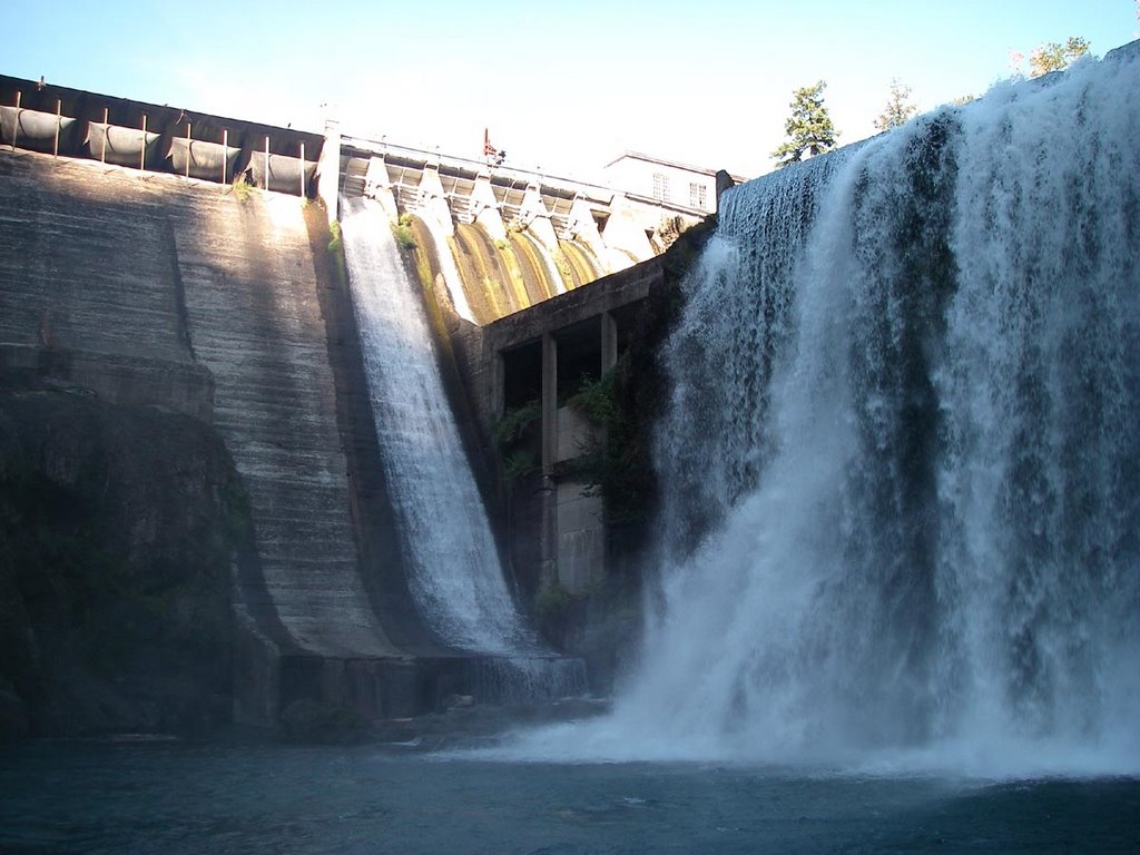
Condit Dam on the White Salmon River.


What the Law Says

The law Gunkel is referring to that would allow this challenge is the Energy Policy Act of 2005, which was signed into law on August 8th, 2005 and does include some new provisions for hydropower relicensing. What Gunkel fails to mention is that there are two parts to this law: first is the option to propose cheaper mitigation options which he does note but the law also states that these alternatives must be no less protective of the fishery resource.

Specifically Section 241 of this law adds section 33 to the Federal Power Act (FPA), 16 U.S.C. 797(e), 811, to provide that the license applicant or any other party to the license proceeding may propose an alternative condition or prescription to mandatory agency conditions (in this case the mandatory requirement for a fish ladder). The Secretary of the agency involved must accept the proposed alternative if the Secretary determines, based on substantial evidence provided by a party to the license proceeding or otherwise available to the Secretary: (a) that the alternative condition provides for the adequate protection and utilization of the reservation, or that the alternative prescription will be no less protective than the fishway initially proposed by the Secretary, and (b) that the alternative will either cost significantly less to implement or result in improved operation of the project works for electricity production.

In practice this means that Klickitat PUD could, assuming they acquire the Condit project, propose an alternative to the fish ladder on Condit Dam. However they would need to demonstrate that their alternative prescription will be no less protective than the fishway initially proposed. This would be a difficult bar to reach at the Condit Project given the extensive record and science supporting the need for fish ladders to restore the long-term health of populations in decline. The law clearly states that alternatives such as trucking the fish around the dam would not be acceptable in cases such as Condit where they would be less protective of the resource. While trap and haul programs have been used at some projects this does not mean that such a program would work at Condit. Every project receives an independent evaluation by fishery scientists. One of the key issues at this particular project is not only adult passage upstream but juvenile passage downstream. Both of these issues would need to be addressed.

Entrance to the Narrows of the White Salmon below Condit Dam.


What About Others Who Have Tried This Approach?

As reported in September by AP writer Jeff Barnard in his story "PacifiCorp loses challenge of fish ladders over dams", dam owners have not had success in using the authority the Energy Policy Act provides to challenge requirements for fish ladders. The Klamath was the first case under the new provisions of the Energy Policy Act where a utility challenged mandates from federal fisheries agencies that it provide fish ladders, screen turbines, and devote a smaller proportion of the river to power production as mandatory conditions for a new license. Administrative Law Judge Parlen L. McKenna agreed with fishery scientists that alternatives to fish ladders did not provide the level of protection required (i.e. that the standard of "no less protective" could not be achieved by an alternative trap and haul program).

Klickitat County has already spent over half a million dollars in legal fees on Condit Dam. Their legal counsel may have suggested that they could challenge the requirement for fish ladders, but one should consider where the advice is coming from: a law firm that would stand to make a healthy profit by extracting additional dollars from local taxpayers whether or not the challenge is successful.

Narrows of the White Salmon below Condit Dam.


What Would the Outcome Be?

To implement the provisions of the Energy Policy Act and initiate a challenge Klickitat PUD would first need to acquire the Condit Project. Since PacifiCorp is not interested in selling, they have proposed to do so by a hostile condemnation proceeding. While it is unclear what the cost of this acquisition would be, what is clear is that Klickitat PUD would then be responsible for meeting necessary mitigation requirements or if they can't, removing the project. If Klickitat PUD acquired the project they could challenge the mandatory fish ladder requirements. The key here is they can challenge them before an Administrative Law Judge, but that does not mean they would be successful and the experience at Klamath would suggest that they would not be. At that point Klickitat PUD would be faced with the prospect of operating a project that costs significantly more to operate than alternative generation sources. In addition Klickitat PUD would be faced with the liability of owning an aging dam nearly a century old.

PacifiCorp, a company with a long history of experience operating and licensing hydropower projects, made the decision to decommission the Condit Project because it is not an economic source of power. Klickitat PUD even hired CH2M Hill, one of the world's leading engineering firms, to conduct an independent review that reached the same conclusion. Klickitat PUD would be wise to not take on the liability this project represents.

Labels: ,