Okinawa Rivers on Iriomote
I just got back from Japan where I had an opportunity to explore some rivers in the southern islands of Okinawa. One of the Islands we went to is Iriomote which is part of a small group of islands to the east of Taiwan. These islands are surrounded by beautiful coral reefs featuring popular dive and sportfishing sites. Not one to be distracted the whole time by pretty colored fish I made a couple of reconnaisance trips to check out rivers on the island.
Iriomote is really an incredible island. Unlike much of Japan it still retains much of its native habitat. Although small (about 20km across), it is one of the few islands that is largely wilderness with much of the interior protected within Iriomote National Park which is home to the endemic Iriomote Yamaneko (Wild Cat). A road runs around the east and north sides of the island with most of the population centered around Uehara on the northwest corner and Ohara on the southeast corner.

Map of Iriomote.
I had planned a cross island packrafting adventure where I would hike in from the southeast to the headwaters of the Urauchigawa and then paddle the river out to the mouth. Unfortunately severe typhoons in September resulted in significant downfall on the trail I was going to use and officials had closed it while they continue to work on clearing it. I took the time to do some scouting for future trips.
Nakamagawa
We spent our first night in Ohara at the Takemori Ryokan. This inn is the best option for exploration of the Nakamagawa (Nakama River) as it's about a 2 minute walk from the front door of the inn down to the main dock where boat tours launch. The inn is well known among adventure travelers as a popular end point for the cross island trail and although it's not budget lodging, the meals are great and the location can't be beat. One of the walls in the dining room has a large topographic map of the whole island pieced together from several sheets and the family that runs the inn always has the latest information on trail conditions.
The Nakamagawa is well known for its impressive mangrove forests and I decided to take my packraft out for a trip up the river and back. I got up a little after 5 am to time my trip with the tides so I could paddle with the rising tide up the river and the falling tide back down. The primary launch point is on the north side of the river just upstream of the main bridge and a short distance from the harbor. The downside is I was floating along with debris and oil from the harbor the whole way up and for such a pristine jungle forest, the river was rather dirty.

Sunrise on the Nakamagawa
The mangrove forests were indeed impressive and the symphony of insect sounds was amazing. The river started out in a wide bay that soon narrowed down to a meandering channel.
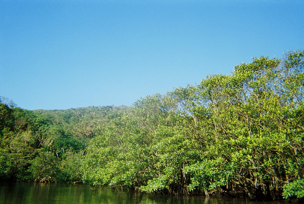
Mangroves on the Nakamagawa. There are a few different species.
One of the highlights of a trip on the Nakamagawa is a chance to see Japan's largest mangrove. This tree is indeed impressive and quite beautiful. The species is Heritiera littoralis which is distributed between India and the South Pacific and tends to grow to the landward margin of mangrove forests. The buttresses at the base of the trunk result in beautiful ribbon type roots. It's easy to find this tree located on the south side of the river where a dock provides an convenient landing site and a boardwalk leads about 100 meters back into the forest where you can see the tree.
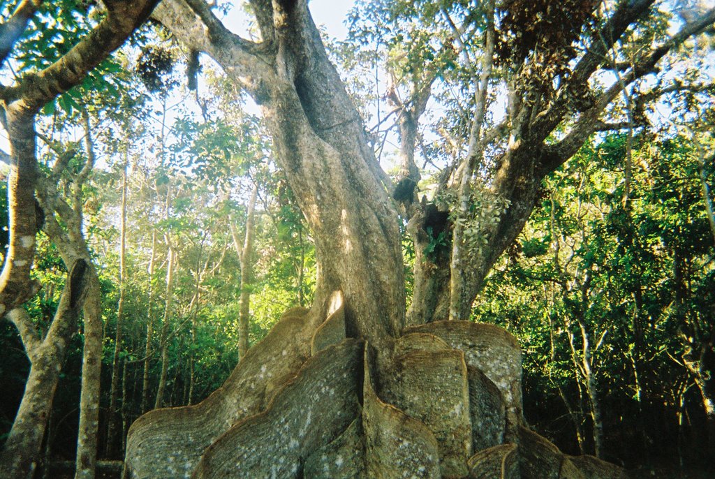
This tree is a mangrove, Heritiera littoralis, and is known as one of the 100 Forest Giants of Japan.
I continued up river to a point about 8km from the start that was still in the zone of tidal influence before I turned around to head back. I was at the inn shortly after 9 am. I will be back to explore areas further upstream on a future trip.
On the Nakamagawa.
Urauchigawa
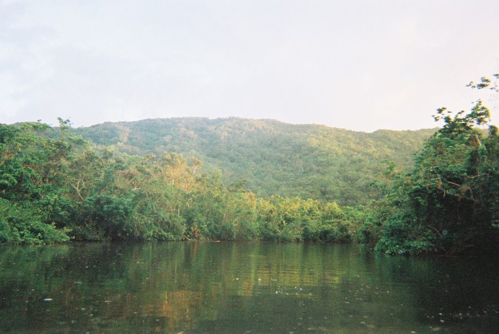
The Urauchigawa (Urauchi River) is probably the most popular river trip on the island and there are several options for taking either a motorized tour boat or a guided kayak trip up the river to a trailhead that allows you to continue by hiking up the river. I had originally planned to descend the river from the headwaters by packraft but we instead decided to make it a family trip and took the motor boat ride up the river to the hiking trail. We stayed at the Akebono Minshuku which is in the Uehara area at the northwest corner of the island. The woman who runs the inn gave us a ride to the boat dock after breakfast but it would be easy to take the bus.
It's about a 30 minute ride up the river with a couple of stops as the guide talks about the different trees and some of the natural history.
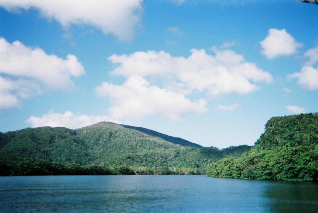
Urauchigawa near the mouth.

The Urauchigawa near the trailhead.

The tour boat docked at the trailhead.

Looking upstream on the Urauchigawa at the trailhead. The tour boats can not continue past this point where the channel is rocky and no longer tidally influenced.
From the boat dock it's about a 50 minute walk up the river to the waterfalls. The trail is well maintained and offers one of the easiest ways to explore the jungle of the island's interior. We saw all sorts of different lizards, insects, birds, and a wide diversity of tree species. We were not able to see much of the river from the trail which is high on the hillside above the river until you get to the waterfalls. The first waterfall is Mariyudu Waterfalls which is a two-tiered falls over bedrock ledges. On our trip you could only view it from the overlook as the trail down to the waterfalls was officially closed due to "dangerous conditions". We saw a couple guys hop the rope but we continued on up to the second set of falls for our picnic lunch.

View of Mariyudu Waterfalls from the overlook.
The trail passes right next to Kanbire Falls, the second set of waterfalls, which is a big bedrock slide. Most everyone stopped here to view the falls and enjoy a picnic lunch. While most day trips end here, the cross-island trail continues on up along the river.

Kanbire Waterfalls.
I hopped in the pool at the base of the falls and pretty soon Aki was looking for his bathing suit. We swam around and pretty soon several other guys had joined us in the water.
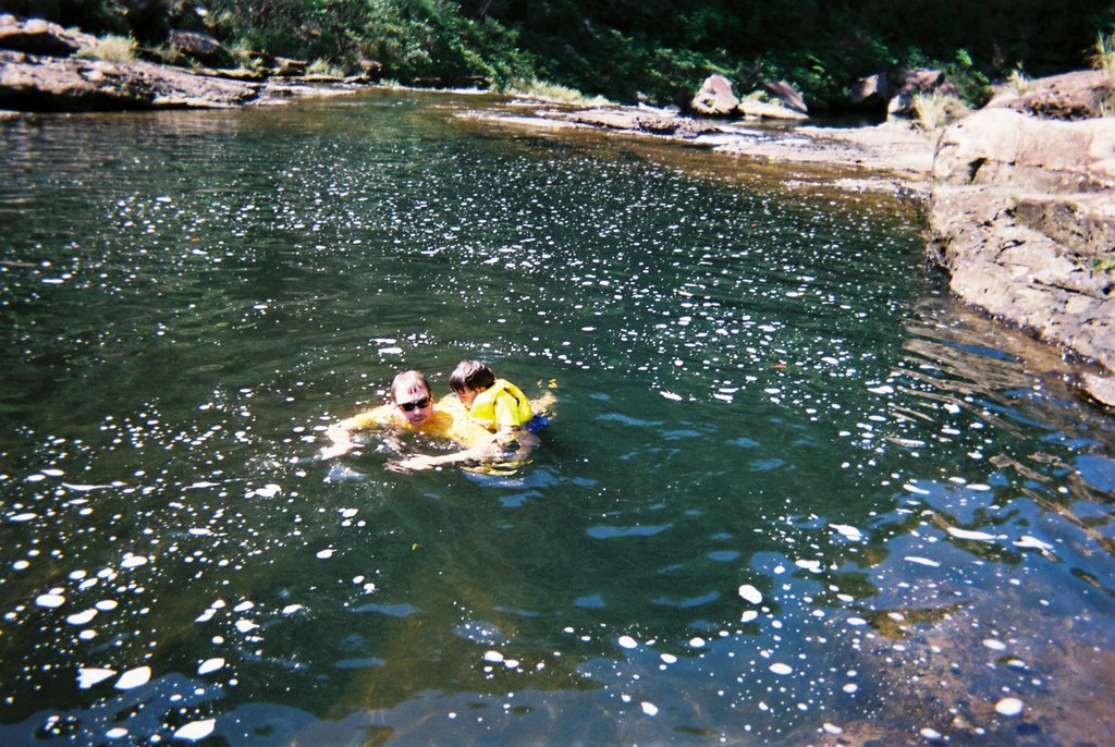
Aki and Tom swimming in the pool at the base of the Kanbire Waterfalls.
After about an hour at the falls we hiked back for the boat ride back down the river. Having checked out the river I think it still holds promise for a future packrafting trip. The waterfalls would need to be portaged but that would be easy with big bedrock shelves along the sides. The gorge downstream of the falls was not visible from the trail. From what we could see from the boat launch it looked like you could get down although there was not much water in spots and you might need to portage. I will be back to check out the river.
Labels: exploration, japan
posted by Thomas O'Keefe @ 5:35 AM
0 Comments
![]()

0 Comments:
Post a Comment
Subscribe to Post Comments [Atom]
<< Home